|
|
|
AUXILIARY WEBSITE LINKS |
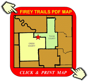
Firey Trails 19756 W. 61st Street S. - Sand Springs, OK 74063
PDF MAPS
Our Address Is: 19756 W. 61st Street S. - Sand Springs, Oklahoma - 74063
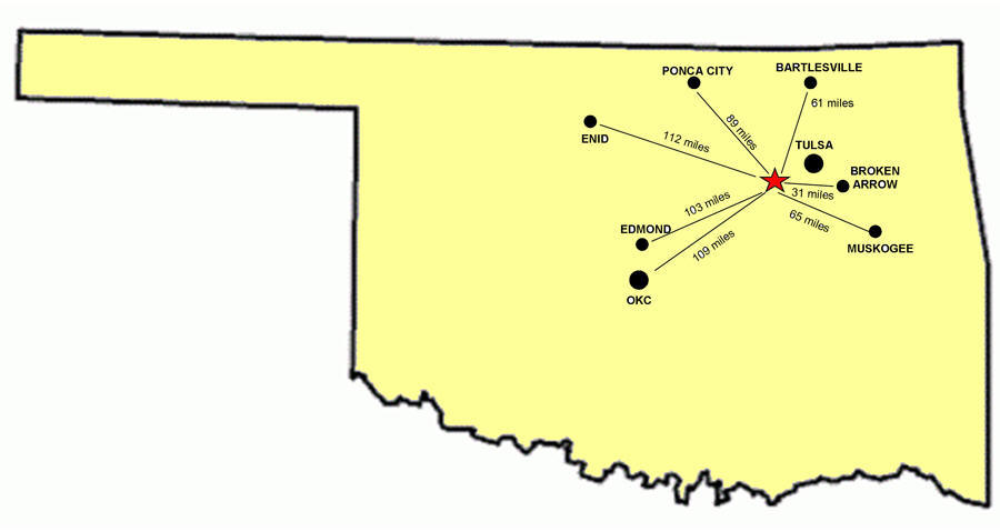
Firey Trails is very easy to find. From the Quik Trip on the southwest corner of Highway 97 and 41st Street (South Sand Springs-Prattville on the south side of the Arkansas River), take 41st Street west 5.3 miles to the Coyote Trail Fork. There will be the first of our large metal signs. Follow the signs (3 total) for almost 3 miles farther, going west (on Coyote Trail after 41st temporarily deads ends), turning south (left) onto 209 W. Avenue and back east (left again) on 61st Street. We are less than a mile east on 61st at 19756 W. 61st Street S. Summary: coming from Tulsa, after you're on 41st, there are only 2 left turns before our Firey Trails gate (where you'll turn right). If you're coming from Sapulpa via the Creek Turnpike, according to GPS and other computer generated map directions, you may be tempted to take the 71st Street Route off of Highway 97, but this is a much lesser road and turns into a narrow dirt road for over a couple of miles as 71st winds and becomes 61st. We always recommend taking the 41st Street route (from South Sand Springs) where you will pick up our large metal signs a little over 5 miles west on 41st (from the Quik Trip on the southwest corner of 41st and Highway 97). We are on the edge of Creek County, south side of West 61st Street with Tulsa County being on the other side of the road.
Previously shown to be our personal address 1/10th of a mile west, we now have registered the actual address of our Firey Trails gate. This new address is 19756 W. 61st Street S. - Sand Springs, OK
© All Content Property of Firey Trails Last Updated: 05/25/2021 07:04 PM |
|
|
|